NORFOLK, Va. — A strong cold front is set to approach the area tomorrow, promoting very gusty winds and the potential for strong storms.
The 13News Now Weather Team has declared a Weather Impact Alert for Sunday.
A warm front will lift north of the region Saturday evening, shifting winds to a southerly direction and significantly increasing temperatures. By Sunday, highs will reach the lower 70s.
A strong cold front will approach the area on Sunday, with high pressure well to the east and the advancing front to the west creating a tight pressure gradient. This setup will result in strong winds, with gusts potentially reaching 50-55 mph ahead of the front’s arrival.

As warm, slightly more humid air lingers ahead of the system, the atmosphere will become modestly unstable. This instability may support the development of a few stronger storms as the cold front moves through by early Sunday afternoon.

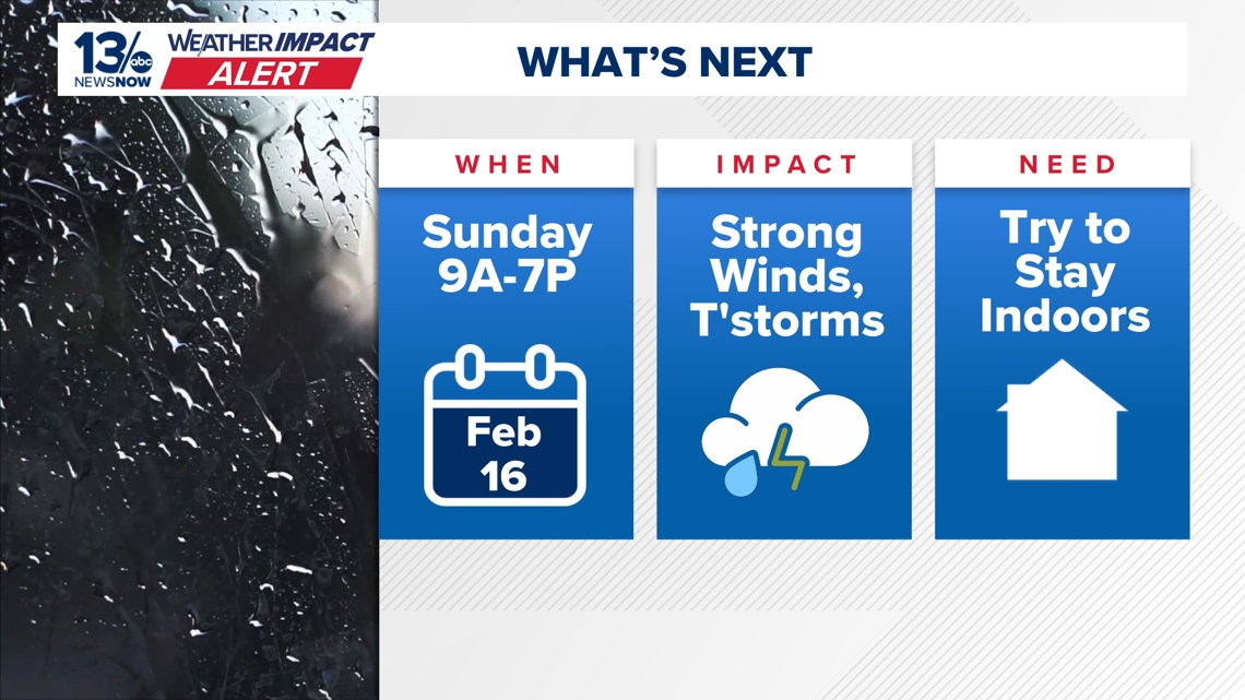
All of Hampton Roads will deal with gusty winds and the potential for strong storms Sunday afternoon.
High Wind Warning & Strong Storm Potential for Sunday
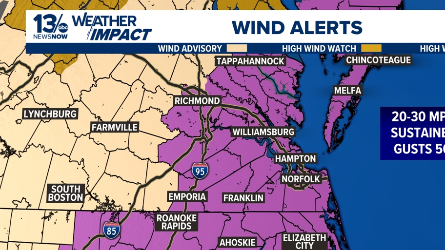
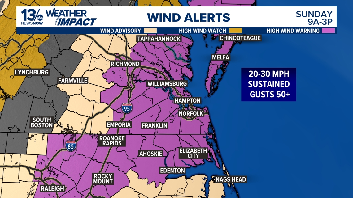
A High Wind Warning is in effect for the entire region from 9 a.m. to 3 p.m. Sunday, with wind gusts potentially reaching 50-55 mph even outside of any thunderstorms.

Winds will strengthen through the morning, peaking from mid-to-late morning into early afternoon as a strong cold front approaches.

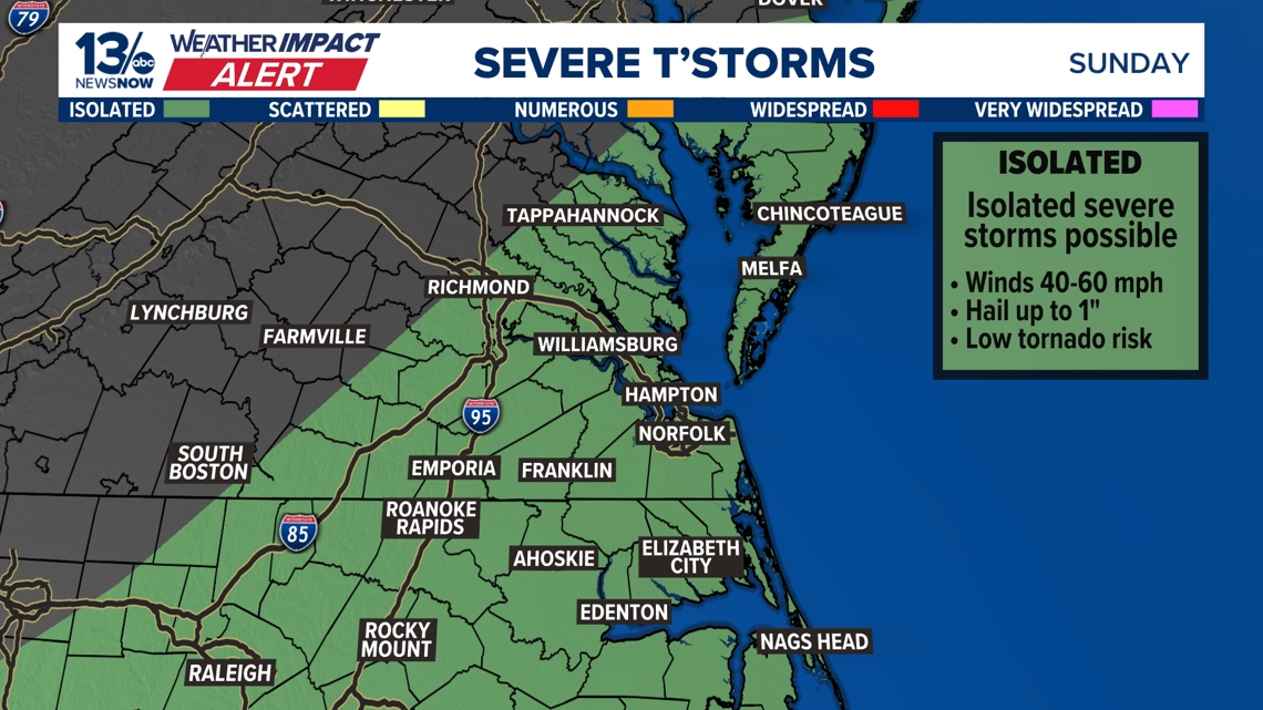
Severe Storm Potential Along the Cold Front:
The front is expected to move through the area from west to east by early afternoon, likely between 11AM and 2PM. The Storm Prediction Center has placed our entire region under a Level 1 out of 5 severe weather risk, with the primary hazard being strong, straight-line winds exceeding 55 mph.
Residents are advised to bring in loose outdoor items that could become airborne, stay indoors and plan travel accordingly.


As always, these details are subject to adjustment, and we’ll continue monitoring new data to provide updates. Stay tuned!