by Allen Strum
Sat, February 15th 2025 at 9:26 PM
Updated Sat, February 15th 2025 at 9:33 PM

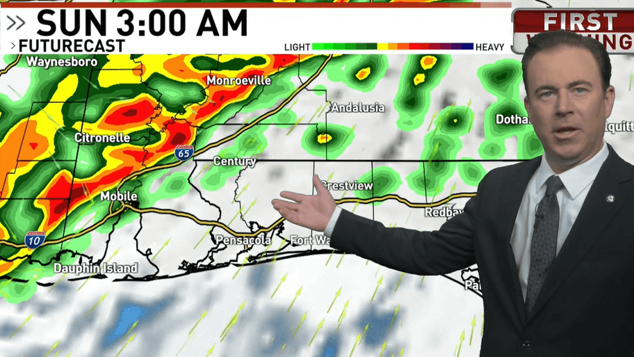
Chief Meteorologist Allen Strum shows the Futurecast model which indicates storms are forecast to strike Sunday morning.

WEAR-TV — A weekend weather maker is forecast to bring more storms to the Southeast.
The most likely time for the WEAR-TV area to get struck is first thing Sunday morning. A line of storms is forecast to develop and move east across the South ahead and along a cold front.
The biggest threat will be damaging winds within the line. If supercell storms develop ahead of the line, the risk for tornadoes will be higher.
The Storm Prediction Center (SPC) has the WEAR-TV zone in a 2 out of 5 risk area, otherwise known as a slight risk zone for severe weather.

In its Friday afternoon forecast discussion the National Weather Service out of Mobile, Alabama said, “..a line of thunderstorms is expected to move across the area late Saturday evening through early Sunday morning. Strong vertical shear profiles and increasing instability levels will support the potential of severe storms along the line. The main threat will damaging wind gusts along the line. A few tornadoes cannot be ruled out especially along breaks and kinks in the line.”
Once the rain is out Sunday morning, cooler air will start to move back in and lows Monday morning are forecast to be down in the 30s. More cold weather is also forecast later in the week.