by Sonya Stevens
Tue, March 4th 2025 at 1:37 PM

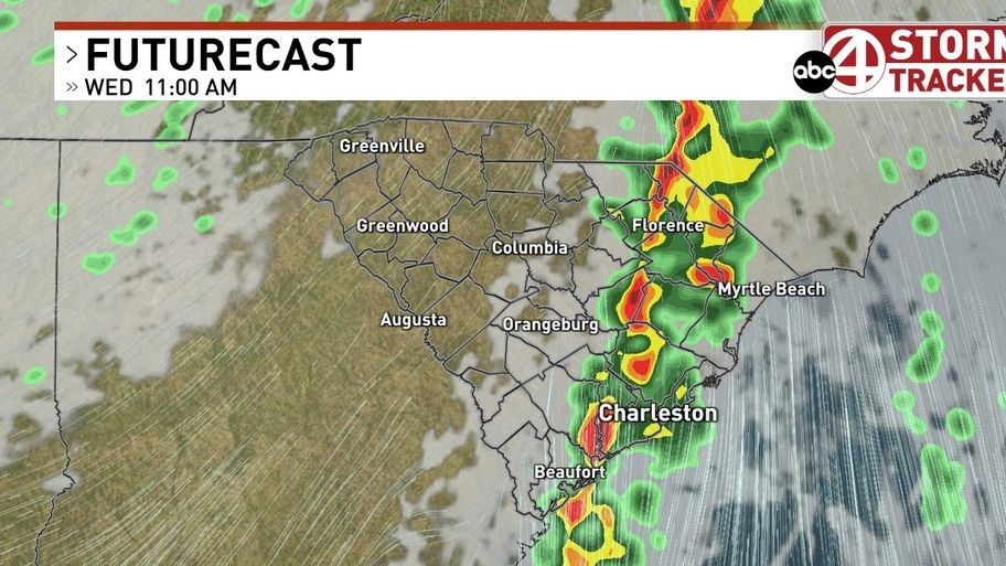
The Lowcountry’s Next Weather Maker is set to bring changes for the middle and end of the week starting Wednesday. (WCIV)
![]() Save Story
Save Story

LOWCOUNTRY, S.C. (WCIV) — The Lowcountry’s Next Weather Maker is set to bring changes for the middle and end of the week starting Wednesday.
A strong cold front will approach Wednesday, sending a line of showers and thunderstorms through the area. There is an enhanced risk of severe weather during that time, according to the Storm Prediction Center.
A few of the storms could become strong or severe with gusty winds being the main threat. Hail and tornado threats are low, but not zero.
The approaching rain is much needed and welcomed as the Lowcountry continues to grapple with various levels of drought.

Storms are expected to move into the area around 9 a.m. Wednesday and exit the area by 1 p.m.
Residents are advised to have a way of receiving weather alerts prepared, and stay weather aware Wednesday.
There is a light at the end of the tunnel. Cooler, drier weather will return for the end of the work week behind the cold front.