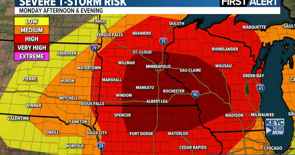
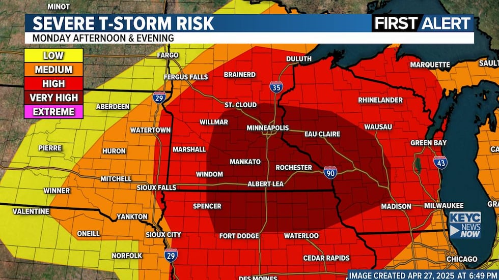
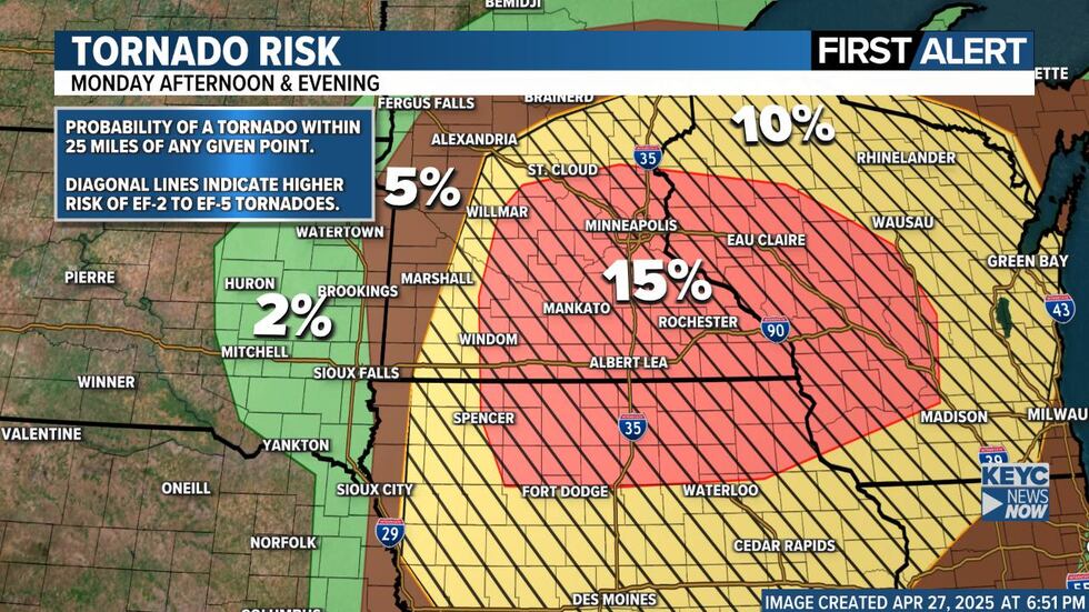
We continue to monitor the potential for a significant severe weather outbreak across the Upper Midwest Monday afternoon and evening. All modes of severe weather are possible — including large hail, damaging straight-line wind gusts, and the potential for strong, violent tornadoes.
A lot of this is similar to what I posted earlier today. Bottom line, we have all the ingredients for significant severe weather on Monday. Check back on Monday morning. We will have a much better idea as to how everything will play out once we see what happens with the storms moving across SD and NE tonight.
Timeline Overview:
Late Tonight–Monday Morning: Scattered thunderstorms across South Dakota into western Minnesota. A few could produce hail, but widespread severe weather is not expected overnight.

Late Morning–Early Afternoon: A break in activity, allowing the atmosphere to reload.
Monday Afternoon–Evening (Main Event): Severe storms likely develop by mid-afternoon from near Marshall and Worthington, MN down toward Sioux City, IA, then move east across southern Minnesota, northern Iowa, and into Wisconsin.
For Sioux Falls and eastern South Dakota: Strong storms possible early afternoon, especially east of I-29. The main threats here will be large hail and damaging winds, with an isolated tornado also possible before the storms race east into Minnesota and Iowa.
Setup:

All the necessary ingredients for a major severe weather event will be in place tomorrow. Warm temperatures, high humidity, extreme instability, and strong wind shear will combine to create an environment highly supportive of severe thunderstorms. If storms can develop ahead of the cold front, the atmosphere will be capable of producing very large hail, damaging straight-line winds, and strong, potentially long-track tornadoes.
What Could Inhibit Storms:
There are still a few factors that could limit the severe threat in some areas. Morning clouds or leftover showers could temporarily stabilize the atmosphere and delay storm development. A layer of warm air aloft, known as the “cap,” may also suppress storms for part of the day. If storms hold off until the front arrives, the threat may shift more toward damaging winds with fewer isolated supercells.
Important to Know:

- This could be a situation where most places stay dry, but one or two storms become extremely dangerous.
- It’s impossible to pinpoint exactly where the worst storms will form. That’s why everyone in southern Minnesota, northern Iowa, eastern South Dakota, and western Wisconsin needs to stay weather-aware Monday.
What you should do:
- Have multiple ways to get warnings (apps, NOAA Weather Radio, TV/radio).
- Review your safety plan tonight so you’re ready to act quickly if a warning is issued.
- Stay alert during the afternoon and evening hours.
- I will keep the updates rolling along tomorrow as the situation evolves.
Tomorrow has the potential to be a very active and dangerous severe weather day. Please stay weather aware and ready to act!
KEYC Weather(KEYC Weather)
KEYC Weather(KEYC Weather)
Click here to download the KEYC News Now app or our KEYC First Alert weather app.
Copyright 2025 KEYC. All rights reserved.