GAYLORD, Mich. — Much of northern Michigan remains under an ice storm warning Sunday as significant freezing rain continues.
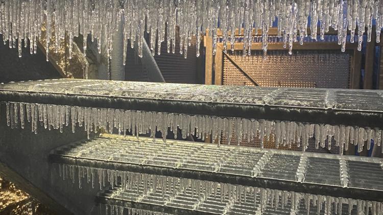
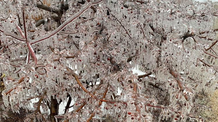
The ongoing freezing rain and wintry mix across northern Michigan since Saturday afternoon has already left over an inch of ice accretion for some, with more expected.

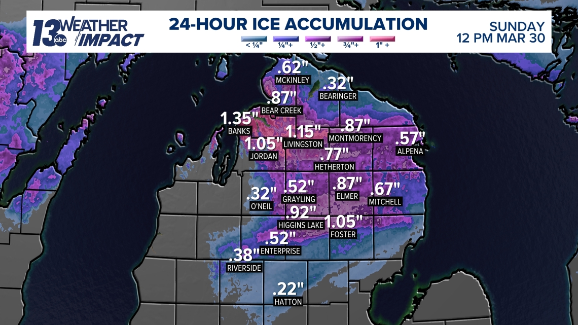
The National Weather Service office in Gaylord estimated accumulations ranging from half an inch to an inch Sunday morning as of 8:30 a.m.
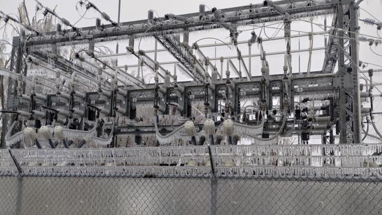
Heavy icing on trees and power lines has already resulted in snapped branches and damaged power lines and poles.


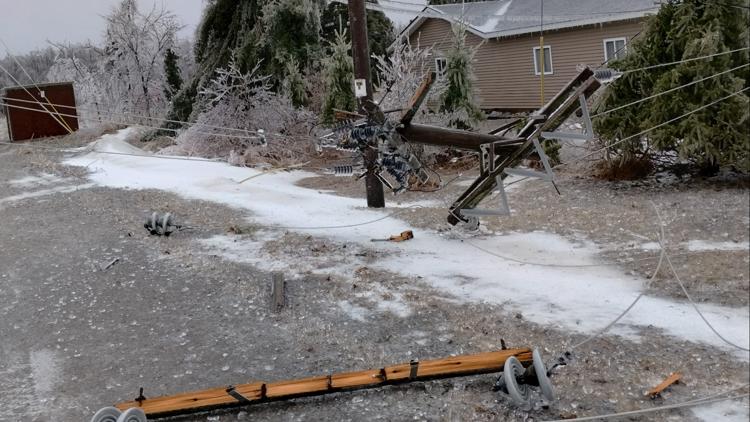

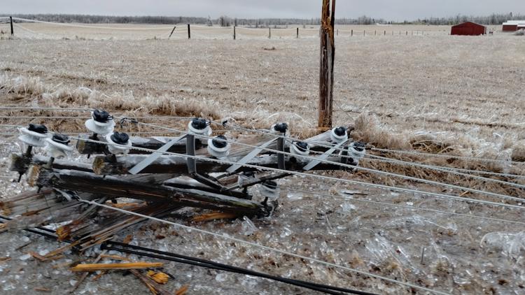


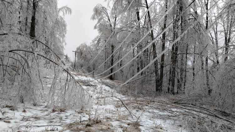

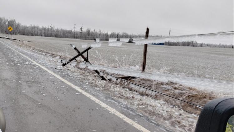

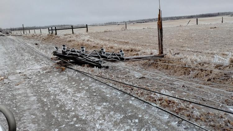


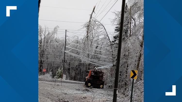

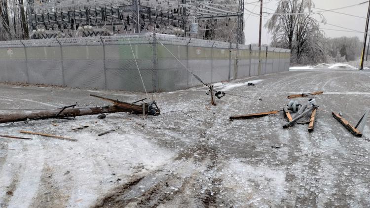

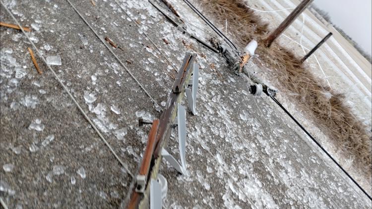

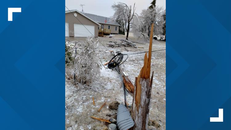

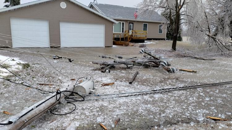


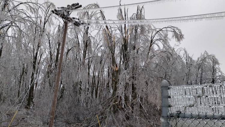
Downed trees and power lines due to the ice storm have left roads across the region impassable.
Multiple area sheriff’s offices and emergency management teams are urging residents to stay home and avoid all travel.
Take a look at this picture that Nikkia Sherman shared with us! This picture comes from Plywood Road on the west side of…
Posted by US National Weather Service Gaylord Michigan on Saturday, March 29, 2025
Ice storm warnings continue until 8 p.m. Sunday evening as more freezing rain and wintry mix is expected to impact the northern half of the lower peninsula and the entirety of the upper peninsula.
Multiple counties in the U.P. are also under winter storm warnings through the day with 3-6″ of snowfall and gusty winds in the forecast.


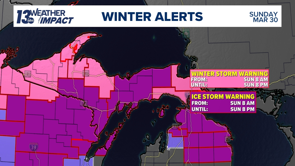
An additional 0.1-0.25″ of ice is still expected across the northern lower peninsula, with 0.25-0.5″ of ice expected further north into the upper peninsula Sunday.
Gusty winds on Sunday and Monday will likely result in widespread, potentially long-lasting power outages.
The National Weather Service office in Gaylord describes these impacts as “crippling” and said that they could last for days.

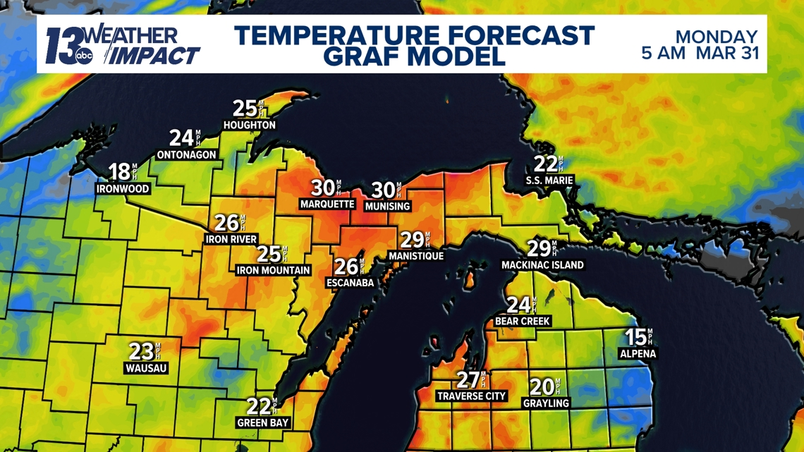
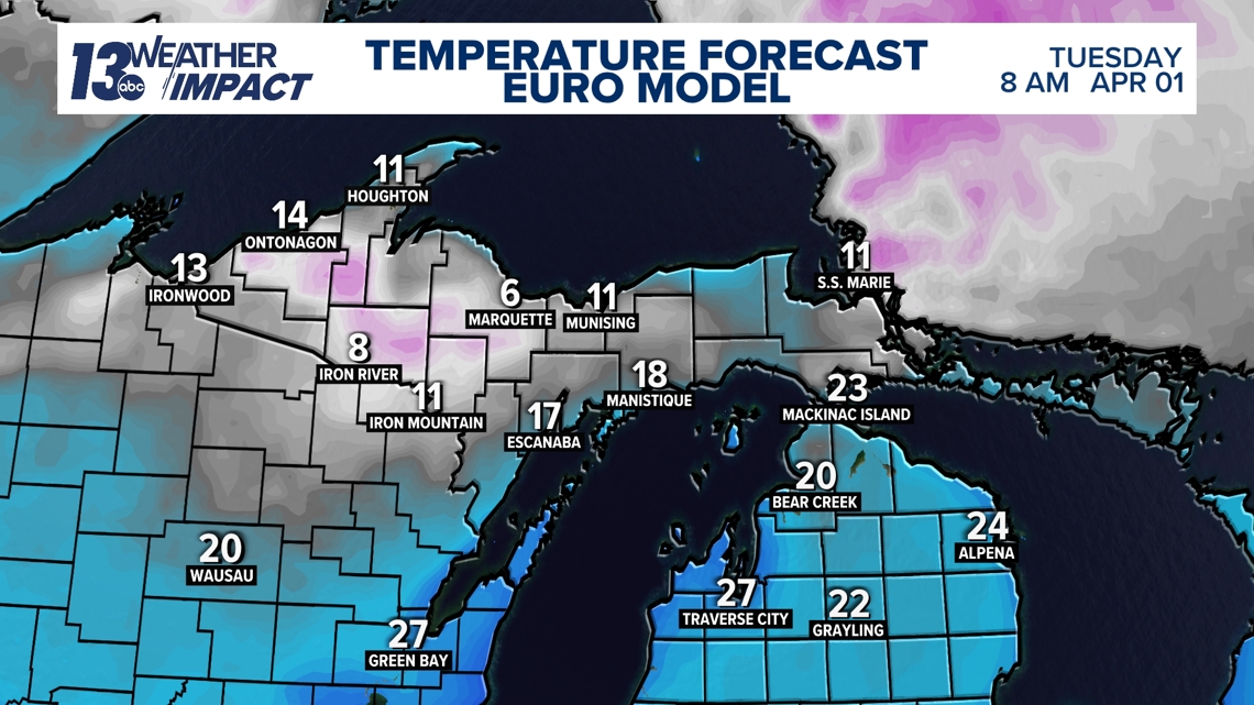
Additional concern comes from the hazards that will remain over the next few days as cold air surges into the Midwest. Temperatures that plummet into the single digits and teens could result in dangerous cold conditions for those without a heat source due to a lack of power.