Severe spring storms are expected in the Metroplex and across North Texas Saturday night into Easter Sunday. A round of showers and thunderstorms will arrive Saturday night and continue into Sunday morning until the disturbance moves out of the area.
At 6:46 p.m., the National Weather Service in Fort Worth issued a Tornado Watch until midnight for parts of northern Texas, including Comanche, Cooke, Denton, Eastland, Erath, Grayson, Hood, Jack, Montague, Palo Pinto, Parker, Somervell, and Wise counties.
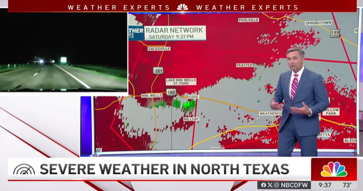
A Tornado Warning remains in effect until 9:30 p.m. for northeastern Erath County and Hood County. A second area of circulation is being watched to the north, where a Tornado Warning has been issued for Parker County and east-central Palo Pinto County until 10 p.m. A third Tornado Warning has been issued for Parker County and northwestern Hood County until 10:15 p.m.
The NWS said there is a tornado debris signature with the tornado that passed northeast of Cool, now approaching Garner in western Parker County.

A Severe Thunderstorm Warning remains in effect for Montague and Cooke counties until 9:45 p.m. for 70 mph winds and ping pong ball size hail. A Severe Thunderstorm Warning is in effect for Cooke and western Grayson counties until 10:45 p.m. for 70 mph winds and quarter-sized hail.
The NWS has issued a Flash Flood Warning for Bowie, Jacksboro, and Nocona until 10 p.m. Saturday with significant flooding ongoing. According to the NWS, up to golf ball-sized hail was seen in Montague County.
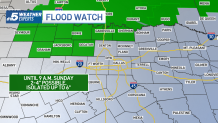
A Flood Watch is in effect for Archer, Cooke, Jack, Love, and Wise counties until Sunday morning.

With this slow-moving system, storms may move over the same areas for an extended period, increasing the risk of flooding.

Some parts of North Texas could see 2 to 3 inches of rain. Be sure to have multiple ways to receive weather alerts.

Egg-cellent news for your Easter egg hunts — the showers are expected to hop out of here by Sunday afternoon!