KYTC DISTRICT 2 AND 3, Ky. (WBKO) – The Kentucky Transportation Cabinet and several county emergency managements have announced flooded roads around the South Central Kentucky area.
Drivers are reminded to not attempt driving through flood waters, with law enforcement reporting several calls about vehicles swept away by floodwaters.
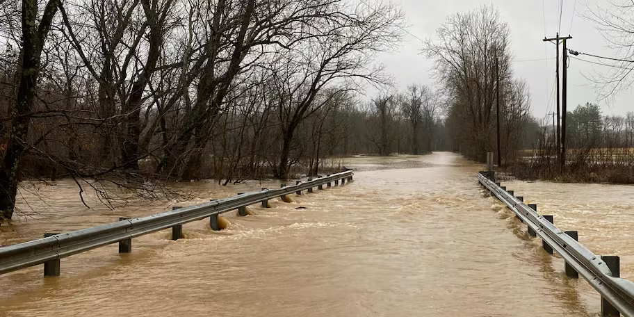
The list below is in alphabetical order and may not include all closed or impacted roads.
Allen County

- KY 585 closed at mile point 6.
- KY 1533 closed at mile point 1.
- KY 1533 closed at mile point 3.
- KY 1332 closed at mile point 3.
Barren County
- KY 740 closed at mile point 5.3.
- KY 3179 closed at mile point 2.2.
- U.S. 68 closed at mile point 0.9.
- KY 685 closed at mile point 6.
Butler County
- KY 340 closed at mile point 7.
- KY 1153 closed at mile point 5.
- KY 2713 closed at mile point 1.
- KY 403 closed at mile point 4 to 5.
- KY 3182 closed at mile point 1 to 2.
- KY 1435 closed at mile point 0 to 1.
- KY 1648 closed at mile point 0 to 1.
- KY 1153 closed at mile point 11 to 12.
- KY 1187 closed at mile point 4 to 5.
Caldwell County
- KY 91 blocked by high water at KY 2080 (NEW)
- KY 126 is blocked by high water at the 1 mile point near Trigg County
- KY 128 open with high water at 3.2 mile point
Christian County

- U.S. 41 open with high water between the 2.6-2.7 mile points
- U.S. 41A open with high water between the 15.2-15.9 mile points (CLEAR)
- KY 109 open with high water between the 10.9-11.3 mile points
- KY 115 open with high water between the 0.8-1.0 mile points
- KY 117 open with high water between the 7.0-11.5 mile points
- KY 124 blocked by high water between 1-2 mile points
- KY 164 open with high water between the 3-4 mile points
- KY 272 open with high water between the 10.3-10.6 mile points
- KY 287 open with high water between their 2.2-3.1 mile points
- KY 345 blocked with high water between the 0-4 and 9.2-9.5 mile points
- KY 380 open with high water between the 1.8-2 mile points (CLEAR)
- KY 400 open with high water between their 0-1.3 mile points
- KY 695 blocked between the 2-3.5 mile points
- KY 695 open with high water between the 12.1-12.4 and 12.7-12.8 mile points
- KY 1007blocked by high water between 0.8-1.4 mile points
- KY 1453 open with high water between 0-2 mile points
- KY 1663 blocked by high water between the 0-2.1 mile points
- KY 3186 open with high water between the 0.4-0.8 mile points
Daviess County
- KY 81 open with high water between the 2.4-3.6 mile points
- KY 142 open with high water between the 4.4-5.9 mile points
- KY 140 open with high water between 1-3 mile points
- KY 298 blocked by high water between the 2-3 mile points
- KY 405 open with high water between 1-2 mile point (NEW)
- KY 762 blocked by high water between the 0-1 mile
- KY 764 blocked by high water between the 1.2-1.3 mile points (NEW)
- KY 1207 open with high water between the 1.4-5,4 mile point
- KY 2127 open with high water between the 0-1.3 mile point
Edmonson County
- KY 655 closed at mile point 2 to 3.
Henderson County
- KY268 blocked by high water between the 7-7.8 mile points
- KY 416 is open with high water between the 10.3-10.6 mile points (NEW)
- KY 812 us blocked by high water between the 4-5 mile points (NEW)
- KY 1557 is blocked by high water between the 2-3 mile points
- KY 2247 is blocked by high water between the 0-1 mile points
Hopkins County

- U.S. 41A blocked by high water between the 12-13 mile markers (NEW)
- U.S. 62 blocked by high water between the 16-17 mile point
- KY 254 open with high water between their 1-2 mile points
- KY 502 open with high water between the 1-4 mile points
- KY 1033 open with high water at the 4 mile points
- KY 2881 open with high water between the 0-1 mile points
- KY 3059 open with high water between 1-2 mile points
Logan County
- KY 1153 closed at mile point 4.2.
- KY 765 closed at mile point 1.8.
- KY 3201 closed at mile point 0.4.
- KY 107 closed at mile point 5.
- KY 3233 closed at mile point 0.4.
- KY 1040 closed at mile point 6.2.
- KY 2375 closed at mile point 3.
- KY 591 closed at mile point 7.5
- KY 1308 closed mile point 1.6
- KY 1041 closed at mile point 6.8.
Metcalfe County
- KY 640 closed at mile points 11 to 15.
Muhlenberg County
- KY 181 open with high water between their 12.7-12.8 mile points
- KY 949 open with high water between the 5-6 mile points
- KY 1379 blocked by high water between the 0-2 mile points
- KY 2107 is open with high water between their 1-2 mile points
- KY 2270 open with high water between the 6-9 mile points
- KY 2533 open with high water between the 0-1 mile points
- KY 2590 open with high water between the 0-4 mile points
Monroe County
- KY 678 closed at mile point 8.5.
- KY 678 closed at mile point 20.8.
- KY 100 closed at mile point 16.5.
- KY 2441 closed at mile point 0.3.
- KY 214 ferry closed due to flooding.
- KY 678 closed at mile point 20.8
- KY 100 closed at mike point 16.8.
Ohio County
- U.S 62 open with high water between their 5-6 mile points
- U.S. 62 open with high water between the 8-9 mile points
- U.S. 62 open with high water between the 15-17 mile points
- KY 69 is open with high water between the 18-19 mile points
- KY 919 is open with high water between the 3-4 mile points
- KY 2670 open with high water between the 0-1 mile points
- KY 2718 open with high water between their 3-4.5 mile points
Simpson County
- KY 585 closed at mile point 5.3.
- KY 383 closed at mile point 4.
- KY 621 closed at mile point 6.
- KY 2593 closed at mile point 1.
- KY 73 mile point 18.
- KY 664 closed at mile point 0 to 1.
- KY 664 closed at mile point 4 to 5.
- KY 1171 closed at mile point 3 to 5.
- KY 100 mile point 17 to 18.
Todd County
- KY 475 closed at mile point 0.0 to 8.1.
- KY 181 closed at mile point 3.7.
- KY 181 closed at mile point 5.9.
- KY 181 closed at mile point 7.
- KY 189 closed at mile point 0.5.
- U.S. 41 closed at mile point 0.4.
- KY 2628 closed at mile point 1.0.
Tompkinsville
- Bushong Road and Pond
- Lyons Bridge at V Comer
- Rhoton Cave Road close to Hendon Rd
- Celina Road at Folly Henson and Mt. Poland
- Armory Road
- Meshack
- Strodetown Bridge
- Dowell Drive
- Green Hills
- Old Glasgow Road 5 Mile Bridge
- The Slap Holder Brother’s Bridge
- Idru Street behind Tri-County
- Highway 100 Lyons Chapel
- 678 at Low Ford
- Mount Gilead Road
- Ebeneezer Road at Gully Creek
Warren County
- KY 263 closed at mile point 5.
- KY 263 closed at mile point 9.
- KY 626 closed at mile point 4.5.
- KY 1083 closed at mile point 2.
- KY 1083 closed at mile point 5.
- KY 242 closed at mile point 7.
Webster County
- KY 132 blocked by high water between 12-13 mile point (NEW)
- KY 138 blocked by high water between the 10.6-10.7 mile points
- KY 270 blocked by high water between the 6.8-8.3 mile points
Copyright 2025 WBKO. All rights reserved.